Blog Reader, Blog Reader, Blog Reader, this is Tammy, aboard Vessel Domino and at the Blog after a very restful night snuggled in with my ACA and Patience.
5:21- We are up very early this morning as this will be a long day of cruising. In fact from Warm Springs to Hoonah will be our longest day of cruising so far this trip. It is approximately 81NM from Warm Springs to the docks in Hoonah and this will set us up perfectly for our cruise into Glacier Bay National Park. Hoonah is 22 NM miles southeast of GBNP.
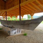
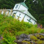
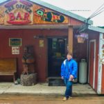
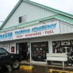
According to what I have read, Hoonah renamed the point to Icy Strait Point and the waterway into Hoonah the Icy Straits sometime in 2004 as an effort to honor the old cannery (approx. 1912-1950) and attempt to bring back individual boaters and cruise ship tourism to the area. Hoonah is home to the largest remaining Tlingit settlement in Alaska (population 800). According to the travel brochures the Huna Tlingit have fished and lived in this area for thousands of years. The town is also home to the Northwestern Trading Company which opened in 1880. The town developed around the cannery and the trading company but in 1944 much of the town was destroyed along with Tlingit artifacts that can never be replaced. In 1946 the federal government assisted in rebuilding the town.
The cruise ship dock used today was built by the Tlingit Indian Corporation. At the top of the dock is the old Icy Straits Cannery that has been saved and renovated into a destination for the cruisers with restaurants, a salmon museum, shopping and a great house or clan house that is used for tribal dance exhibits. From the look of the town it is really just an old blue collar village still inhabited by generations of cannery workers, lumber jacks and fisherman. I have read and heard that the Tlingit nation is attempting to modernize Hoonah so that their history will survive and their stories will still be told. I think it is the cruise ship companies that are building massive new docks so that they no longer have to load passengers into tenders to take them to the cultural center. Also, it is important to note that Glacier Bay National Park which is now operated by the federal government was all Tlingit land to begin with and then glacier area which drove the Tlingit to Hoonah. I was surprised to find out that Glacier bay did not become a national park until 1980. I have read that the Tlingit leadership still have a fair amount of influence on the management of the park as this land and the life within the 5000 sq mile area belonged to their people thousands or possibly tens of thousands of years.
Today, Glacier Bay National Park is managed very closely. You have to have a permit to enter the park and you are restricted to the time that you can spend there so we will treat every minute of our time there precious and special. Today there is no charge for the permit but they are not easy to get and the are booked out as soon as they open up online. Thanks to my very smart husband he stayed on top of the process and we have ourselves a 7 day permit to enjoy one of the worlds most amazing natural wonders. The park is a safe place for the recovery and recolonization of the receding glacial land with plant and animal life and we can’t wait to see as many as possible. I am counting down the minutes until we can enter the park.
So we will share the Helm today and everyone will get an afternoon nap so that we are well rested for our arrival in the park in a few days.
12:14- I was at the Helm and monitoring Channel 16. The coast guard has called out several times now in the last hour announcing that there is a boat adrift called Amelia III. There are 3 persons aboard and they have no working radio. They have asked that anyone seeing the boat call the coast guard immediately and render aid if practical and safe. The boat has apparently attempted to drop anchor but it is dragging on a rocky bottom and they have had no luck and are adrift. I noted our Longitude and Latitude as well as notes about the announcement and will inform the captain when he wakes up from his nap. We are not near the last known location but will be keeping my eyes open for the boat anyway.
It is a calm day and the water is like glass so I hope that they will be ok and not be washed ashore or into the rocks. I would say that we have approximately 1-2 kts of winds from the north and on our bow. The swell is also on our bow s o today is easy boating.
2:15-I am still at the Helm and just heard a distress call from a motor vessel Ulthule which is currently positioned about 10 minutes behind our location. He has called the Coast Guard on 16 and announced a Pan, Pan. He must have gotten too close to a group of whales bubble net feeding and he has hit a whale. He thinks he is taking on water and is turning into False Bay to access the damage. I have radioed back to Ulthule on 16 and announced my location and my willingness and time to arrive to render assistance. He has a couple of adults and children on board and he was headed to Juneau. He thanked me and agreed to stay in touch as we motored to him.
2:25- We did not get all the way into False Bay when he called us back and announced that he has accessed the damage and that he thought he was ok and could continue on. The Coast Guard was already overhead in a Helicopter and continued to ask questions regarding his shop and their condition. We all agreed that he would trail behind us for some period of time until he was certain that he was going to be ok. The Coast guard requested that he stay in touch with them and let them know when he had arrived at a destination for the evening.
This is probably a good time to talk about the international radio phrases or terms that are used on marine radio to ask for help or announce navigational intentions.
- Securite – (French word for Safety). You use this callout to announce navigational intention in narrow passages or to raise boats that might already be in the passage to ascertain their position. You go to channel 16 and this is what you say: "Sécurité, sécurité, sécurité", this is Motor Vessel Domino transiting Endicot arm in 30 minutes outbound. Concerned or apposing traffic please respond on Channel 16." If you are a vessel in the same area and headed down the same passage coming at them then you announce yourself and work out with the other ship how to pass them safely. Usually you will pass port to port or they may ask you to wait until they come through the passage if it is really narrow or it is low tide. You could also ask them to wait if you are farther up the channel and can’t stop or move over.
- Pan Pan – (Panne’ is the French word for broken as in a breakdown or a mechanical failure. A three-letter “backronym” (Andrew and I both learned a new word) "possible assistance needed" is derived from "pan". You use this callout to announce a significant problem and you may need help but there is no immediate danger to life. You go to channel 16 and this is what you say: "Panpan! Panpan! Panpan! This is motor vessel Domino requesting assistance. We have lost power and are drifting 3 miles west of wood spit. Our Longitude is XX and our Latitude is XX. The vessel is a 40′ white Willard trawler with a blue bimini.. There are 2 persons and a cat aboard. Requesting any near by vessel to respond." And you keep calling this until you either get the Coast Guard or nearby vessel responding. This call out is just to keep informed that you are having trouble but if things escalate and the trouble becomes life threatening then you move on to the next level call out which is Mayday.
- Mayday –Morse Code was used before voice calls and SOS would have been the signal in Morse code for help. Frederick Mockford, a Sr. air radio officer in London established the word Mayday and 1923. It was taken from the French word m’aidez which means ‘help me”! It was adopted by IRC 1927). You use this call term to ask for help in a life threatening situation. You go to channel 16 and this is what you say: "Mayday! Mayday! Mayday! This is motor vessel Domino requesting immediate assistance. We are adrift and taking on water. We have hit a reef and the boat is damaged. There 2 adults aboard and one cat. The vessel is a 40′ white Willard trawler with blue bimini. Our last known position was 1 NM northeast of midway island in Stephen’s Passage. We estimate our longitude to be XX and our Latitude to be XX. Any vessel in the area please assist urgently. " You would also call out to the Coast Guard and continue calling until you make contact.
2:45 The Ulthule is a smaller speed boat and is now well underway towards Juneau and thinks that they are ok. They called us back on 16 and thank us for our help and announced that they were going to break off and go ahead and go to Juneau. If we didn’t know it before we certainly are convinced now that radio monitoring and contact are absolutely necessary when you are boating in open water and in my opinion AIS transmitters should be required on all Vessels for the safety of all aboard.
6:10 We arrive on Hoonah after a very exciting day and are ready for dinner. Also ready for an early night as we are all pooped! We stretched our legs on the dock and took little kitty for a walk and is really much more like a skulk. Dinner and then we hit the bunks. I am already dreaming of the many species that we will see in Glacier National Park.
This is Tammy very signing off and standing by on Channel 16.
· Left Dock/Weighed anchor: Anchor up at 5:21 AM
· Cruise Log: 81 Nautical Miles
· Weather Conditions: No wind and sunny
· Navigational Obstacles: Several cruise ships passing through Stephen’s Passage. Panpan call and Coast Guard call for a missing boat and a boat rescue.
· Wildlife Sighting: Mommy whale and Baby. Also distant view of bubble netting which is the same group that Ulthule must have hit. We also saw seals today.
· Arrived Dock/Dropped anchor: Roped off at 6:20 PM
· Slip for the night: $25
· Lessons learned: How to respond to a Panpan call.
· Fun Meals underway:
· Time today Helm for TEA: 5 hrs
· Time today Helm for ACA: 8 hrs
